SOLUTIONS FOR GEOENGINEERING

MONITORING AND EARLY WARNING SYSTEM
Design, installation and operation of the best geotechnical and structural monitoring system
Continuous, discontinuous, and combined 2D and 3D methods for solving geotechnical problems
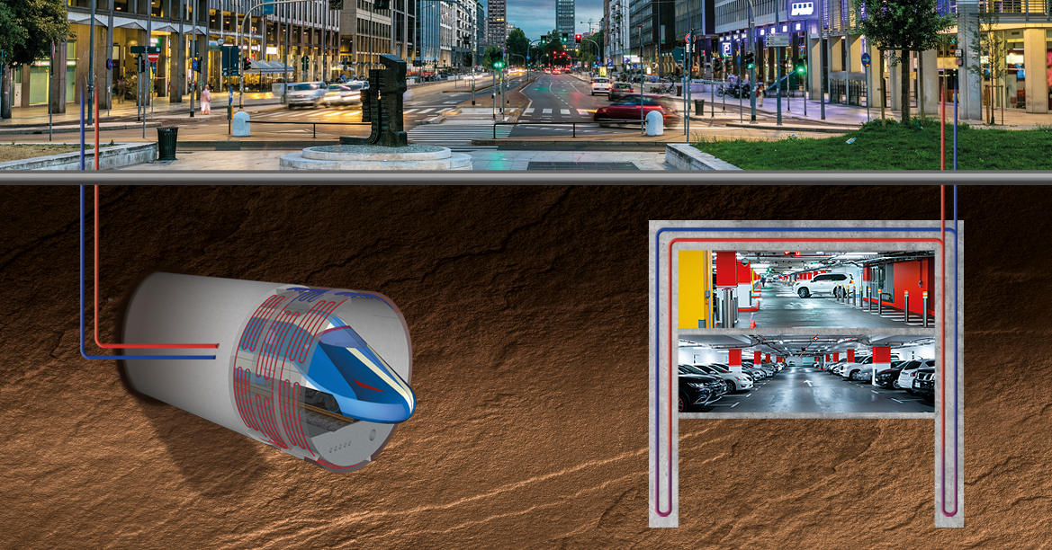
Design and implementation of the best innovative solution to derive low-enthalpy geothermal heat
Best solutions in the field of rock and soil mechanics
Geosolving experts are the ideal support for the resolution of geological and geotechnical problems that may arise during construction of civil infrastructures.
Geosolving adopts the most advanced techniques worldwide available from numerical modeling to advanced monitoring.
These are applied to the design of infrastructures, of aqueducts and sewer systems and to geothermal applications.
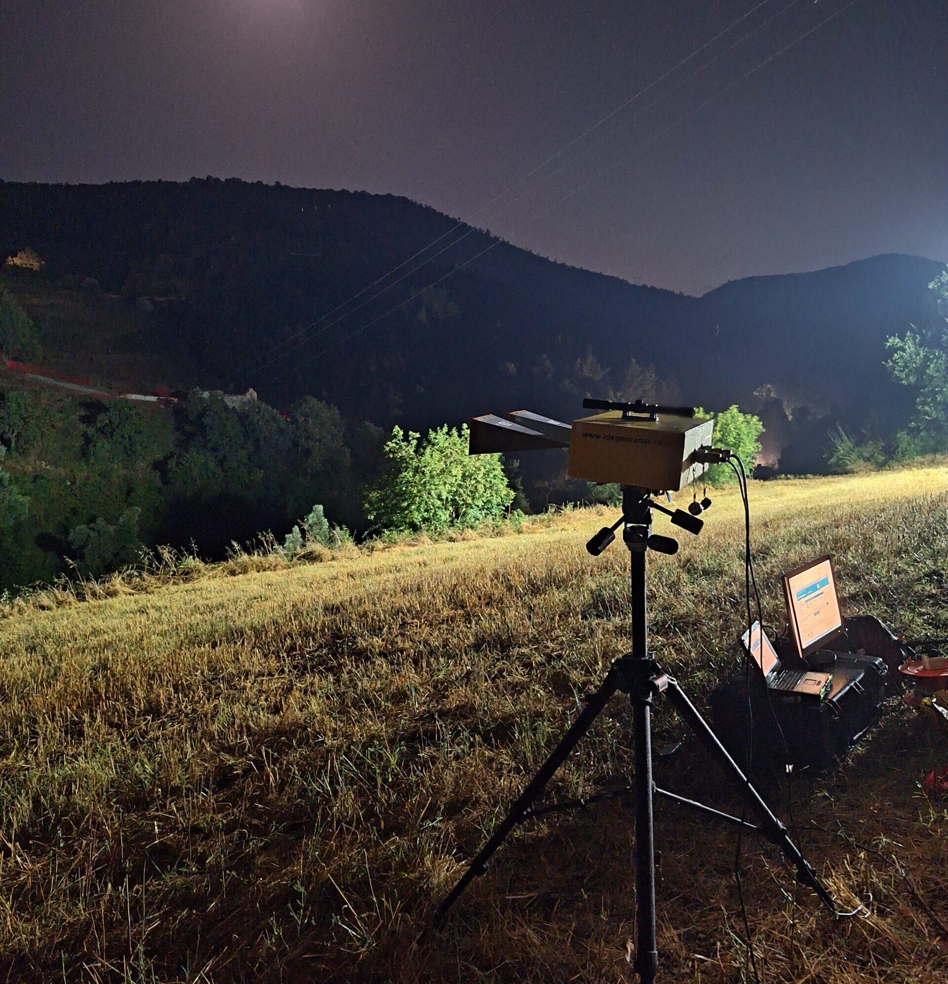
GBInSAR can be adopted to monitor unstable slopes with millimetric accuracy.
We are familiar with FEM, DEM, FDEM softwares such as FLAC, UDEC, 3DEC (Itasca), RS2 (Rocscience), Y-Geo, ecc.
3D numerical modelling is not problem, both in continuum (FEM, FDM) and discontinue (DEM).
Topographic and laser scanner surveys.


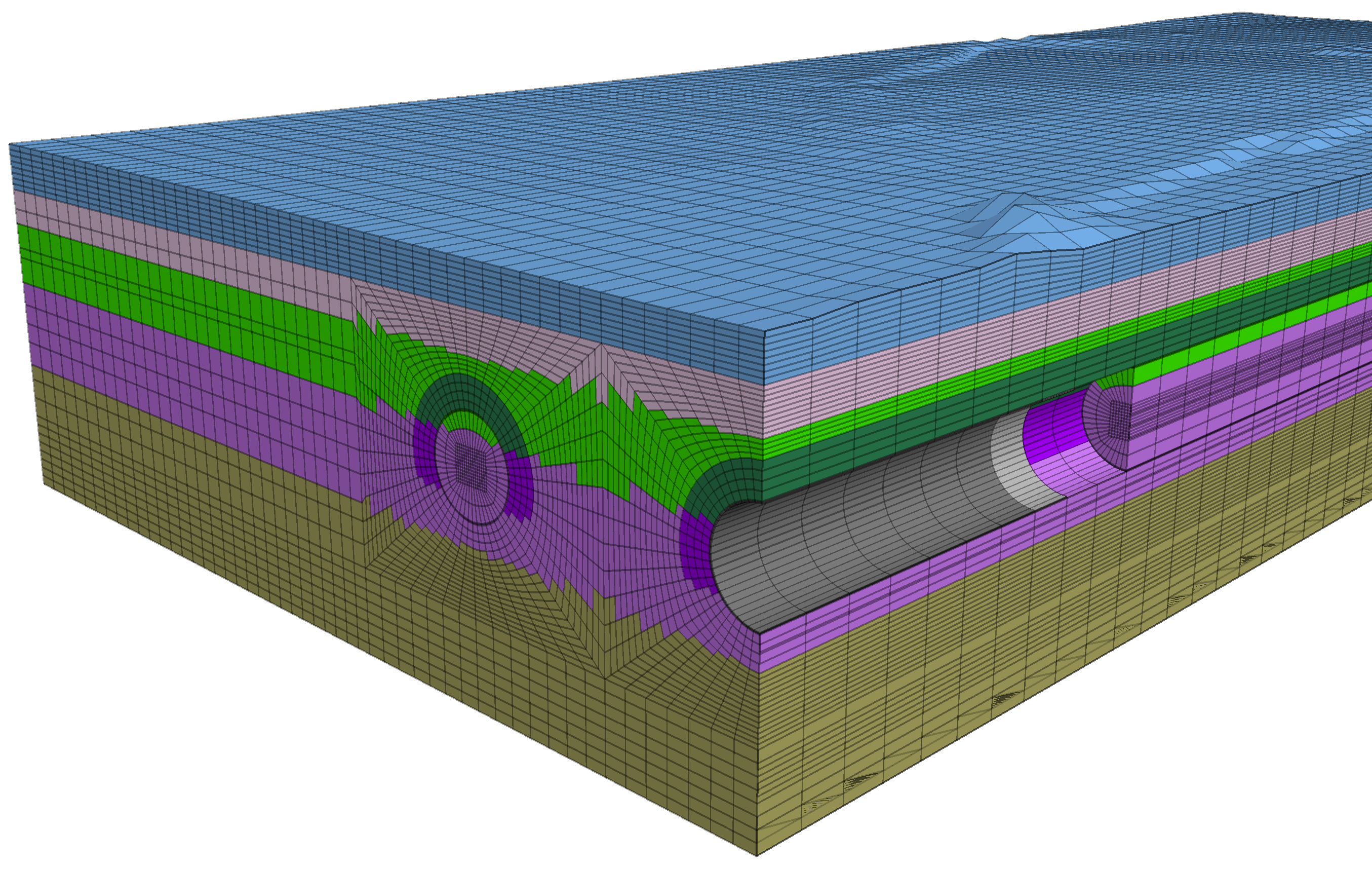
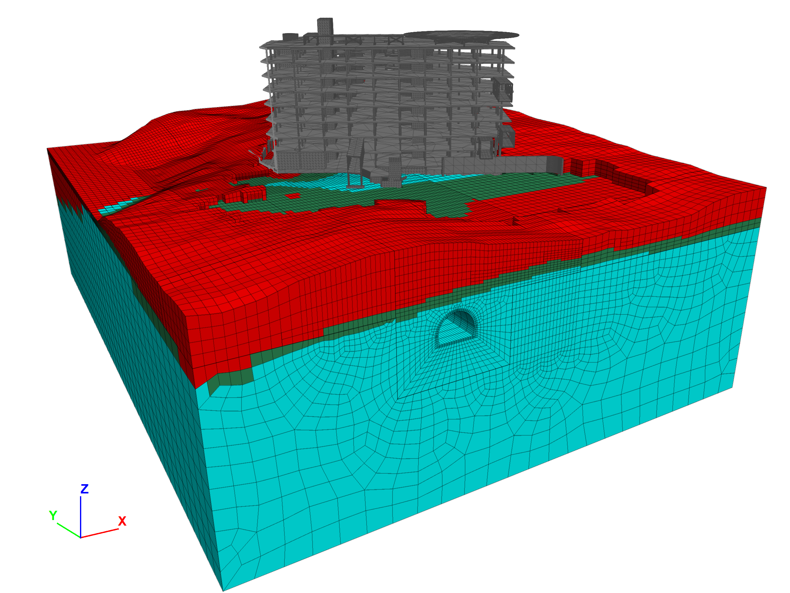
As part of the study of the interaction between the Sparvo tunnel and the slope it crosses, Geosolving developed a three-dimensional numerical model with the objective of evaluating the evolution over time of the interaction between the tunnel and the large complex landslide present at the site. After a detailed reconstruction of the geologic conditions Read more about Three-dimensional numerical analysis for studying the interaction between tunnel and large complex landslide[…]
Geosolving offices will be closed from 12 to 23 August. You can still contact us by email.
We are pleased to share our latest experience of ground radar interferometry monitoring for Amplia Infrastructures. During the demolition of the south lane of the Goccioloni 2 viaduct along the A1 Milan-Rome motorway, Geosolving monitored the movement of one of the stacks of the viaduct. Thanks to the high precision interferometric measurements, it was possible Read more about Radar monitoring from the ground during the demolition of a viaduct[…]
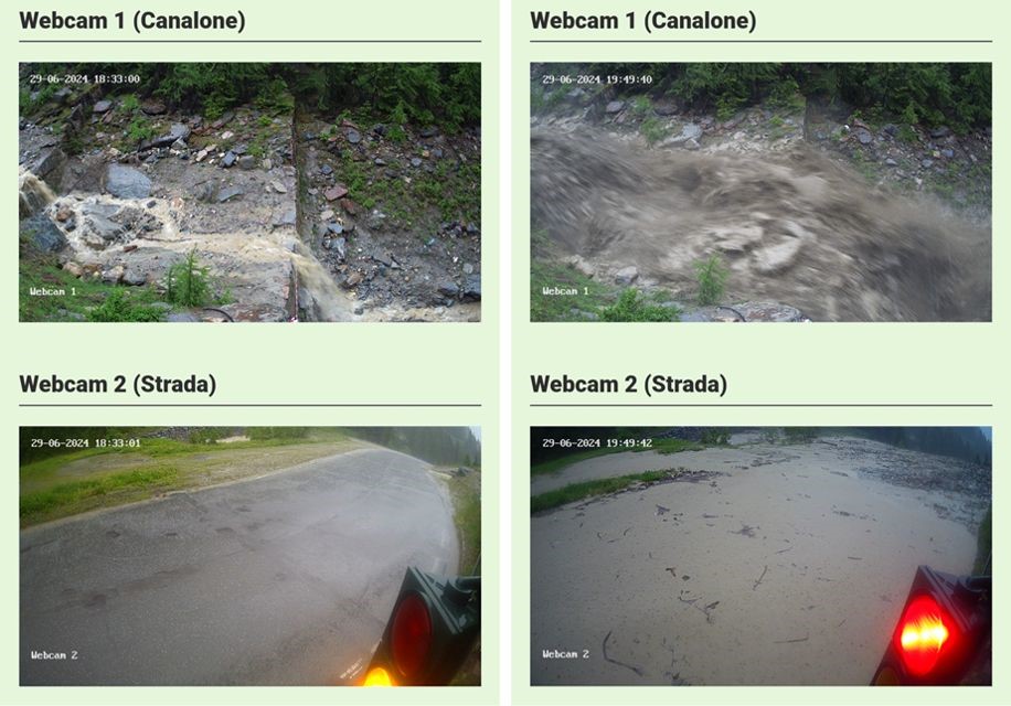
On Saturday 29 June, the area of Cogne (AO) and in particular the Valnontey was affected by a flood event of considerable intensity that involved the activation of a series of debris flows along many gutters and the flooding of streams. During these events it becomes clear how crucial monitoring and rapid alert (EWS) activities Read more about Debris flow detected by EWS GeoAndes[…]
When new construction is planned, it is important to study the effect that this has on existing works. This is the case of the new Pavilion 0 of the Giannina Gaslini Institute in Genoa, which will be built at the Lamba Doria double-track tunnel on the Genoa-Pisa line. For this reason, Geosolving has developed two-dimensional Read more about Numerical analysis for the study of interference between the construction of a new hospital pavilion and the Lamba Doria gallery[…]
The first phase of work that directly involved Geosolving in the pre-factility study for the geothermal activation of two newly built railway tunnels in the cities of Hamburg and Stuttgart, Germany, has just ended.Geosolving, in collaboration with the Institut für Geotechnik of the Technische Universitat Darmstadt, supported Deutsche Bahn in the choice of the best Read more about Pre-feasibility study for geothermal activation of railway tunnels in Hamburg and Stuttgart[…]
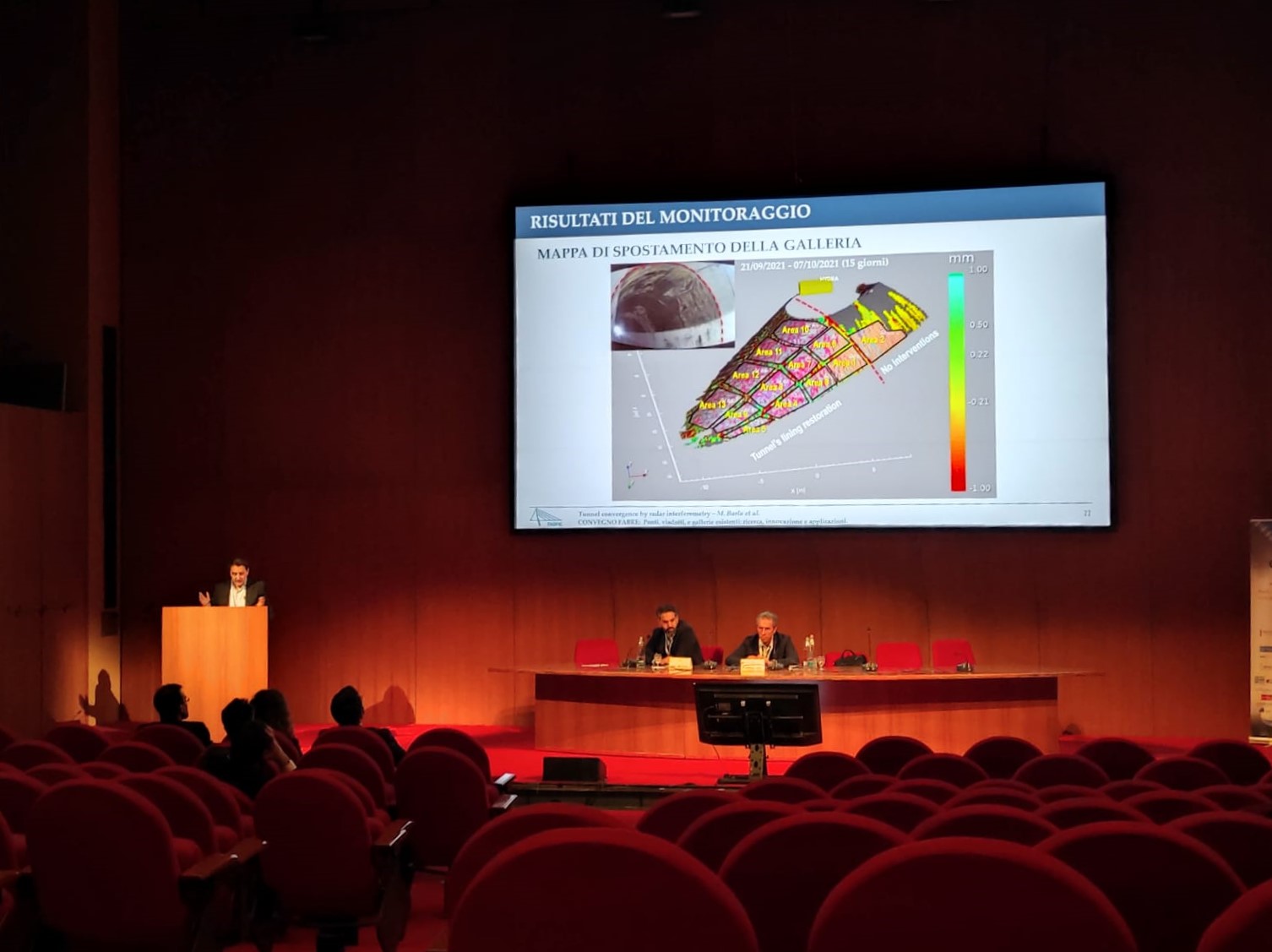
During the II conference of the FABRE Consortium, Francesco Antolini of Geosolving showed an innovative application of ground radar interferometry. Specifically, this application developed for the monitoring of the lining of tunnels subjected to maintenance operations allows to mitigate the risks associated with different types of processing.
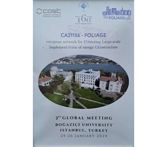
Geosolving as the only Italian company involved in the geostructures sector is pleased to have participated in the 3rd Global Meeting of the COST Action, which was held on 25-26 January in Istanbul, at Boğaziçi University. It was an opportunity to meet in person with colleagues from Working Group 2 “Case studies and performance data” Read more about 3° GLOBAL MEETING FOLIAGE AT BOĞAZIÇI UNIVERSITY ISTANBUL, TURKEY[…]
The Geosolving team wishes you happy holidays and a happy 2024! Please note that the office will be closed from 27 December to 5 January.
Geosolving is pleased to announce that the PolarALP project regarding testing of a new early warning system based on fiber-optic sensors for mitigating the risk generated by avalanches, debris flows and rockfalls for infrastructures in Alpine environment was co-funded by Unione Europea NextGenerationEU in the framework of Bando a Cascata per le imprese Spoke 4 Read more about PolarALP Project: Testing of a new early warning system based on fiber-optic sensors[…]